THE GREENSAND RIDGE WALK

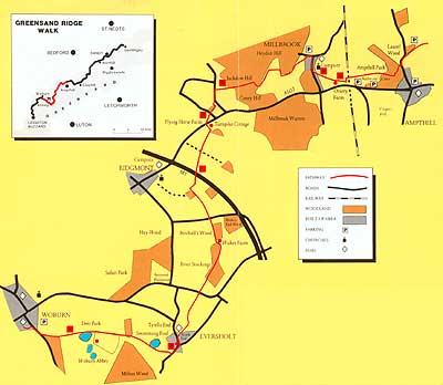
This 40 mile walk is almost entirely in the County of Bedfordshire (approximately 17 miles are actually within Marston Vale) and was opened in 1987. The name of the walk comes from the layer of lower greensand which bisects the County. Greensand is a mixture of sandstone and sand. The sandstone contains a green iron-bearing mineral which gives some of the stone a greenish tint. Many churches along the route give examples of the colouring.

For simplicity the walk has been divided into four sections-
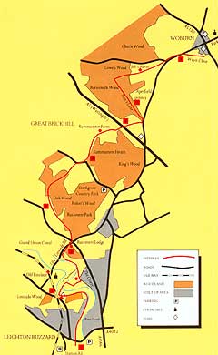
1. (left) The walk begins in Leighton Buzzard and as can be seen from the map below takes the walker across the River Ousel, through various woodland areas and across the Watling Street (A5), towards woburn.
Community Forest

Country Park

Greensand Ridge Walk Section 2

Marston Thrift

Water Sports Club
2. ( below) The next stage of the walk crosses the Deer Park at Woburn Abbey. Here the walker will find nine different species of deer in 3,000 acres - one of these deer is called the Muntjac and has been used as the symbol on the waymark signs which indicate the Greensand Ridge Walk. The walk continues across the M1 and past Turnpike Cottage which stands on the site of a tollgate known as Lidlington Gate. The road (A507) was the main coach route between Oxford and Cambridge.

From here the walk turns off the main road to Jackdaw Hill from where there are good views of Marston Vale. The route then continues towards Ampthill.

Back to top