 |
 |
 |
 |
 |
 |
 |
 |
 |
 |
 |
 |
 |
 |
 |
 |
 |
 |
 |
 |
 |
 |
 |
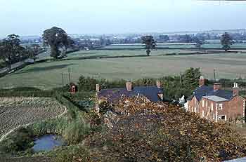
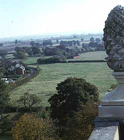
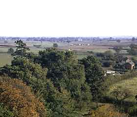
View from the church tower in the late 1960's
|
 |
 |
 |
 |
 |
 |
 |
 |
 |
 |
 |
 |
 |
The view from the church tower is magnificent. These photographs were taken in the late 1960's before the construction of the new houses and industrial areas, before the coming of Willen Lake and before the Cotton Valley Sewage Works. They contrast starkly with the view from here in the year 2000 |
 |
 |
 |
 |
 |
 |
 |
 |
 |
 |
 |
 |
 |
 |
The photo above shows the view looking north towards Newport Pagnell over what is now the housing development around Aldrich Drive. The road on the left is now Thursby close and a redway out to Dansteed Way. The pond is still there, as are the cottages which were the last to be built before 1881. |
 |
 |
 |
 |
 |
 |
 |
 |
 |
 |
 |
 |
 |
These photos show the view looking south. The left hand picture is looking towards Milton Keynes village. The construction of the new sewage works has just begun in the middle ground. On the right you can see the fields that are now under Willen lake. The clump of trees beyond the old barn indicate the site of the medieval moat. |
 |


