Bury Field
re-seeded after the war, it looks nothing like it used to, according to many Newport Pagnell residents.
|
|
Bury Field |
||||||||||
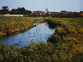
| This common land lies to the north of the town centre. It's boundaries today are Lakes Lane, Queens Avenue and the River Ouse. | |||||||||||
| The land came to the Crown after the disolution of the monastries in the 17th century, who in turn granted it to Dr Atkins - towns people could graze their animals there. | |||||||||||
| In 1942 the field was ploughed up to be cultivated for food during World War 2. All the bushes, lush grass and wild flowers disappeared, and although re-seeded after the war, it looks nothing like it used to, according to many Newport Pagnell residents. |
|||||||||||
|
|
|||||||||||
| During the war, an Observer Corp look-out post was set up in Bury Field to track the course of enemy aeroplanes. It was manned by volunteers attached to the Air Force. Information was passed all over the country, so that likely bombing targets could be alerted. | |||||||||||
| Barbara Newcombe talking about improvements for Queen Victoria's Jubilee | |||||||||||
| The land is now owned by the Council and it has maintained that it "shall not develop Bury field except for amenity purposes, and that no residential, commercial, or mineral extraction is to take place". | |||||||||||