 |
||||||||||||
 |
||||||||||||
 |
||||||||||||
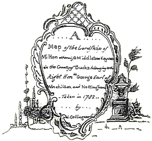
| The map shows the Milton Keynes Parish as it was in the late 18th Century. It was drawn by William Cullingworth in 1782 for the then Lord of the Manor, Right Honourable George, Earl of Winchilsea and Nottingham. George was a descendent of Daniel Finch whose family purchased the estate in 1677 and held on to it until early in the 20th century. It was then purchased by the Merchant Venturers who remained the landlords until it was acquired by the Milton Keynes Development Corporation to build the new city of Milton Keynes. | ||||||||||||
| The 18th century saw many estate maps being drawn up by wealthy landowners because of advances in surveying techniques and development of cartographic skills. These new skills had been gained by many surveyors on the battlefields of Europe and in the growing British Empire whilst serving their King and Country. Some landowners had estate maps drawn as status symbols to show of the extent of their land holdings whilst others wanted to clearly record the extent of their land ownership following a busy century of enclosure awards that increased the control of the landscape for a powerful minority. |
||||||||||||
 |
||||||||||||
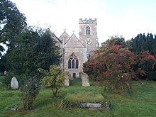
| All Saints Church Milton Keynes | ||||||||||||
| The map clearly shows the two rivers that form natural boundaries to the parish and it names and catalogues all the fields found there. The parish inventory recorded the size of each field and could be used to calculate how much rent was to be paid by tenant farmers to the Lord of the Manor. These maps were surprisingly accurate and can be overlaid with more modern maps to compare changes in land use. The rural landscape of Kents Hill can be seen to have changed very little in over 400 years until the arrival of the new city. |
||||||||||||
| Back to top | ||||||||||||