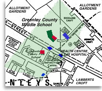
This map shows the location of the allotments once the 1927 tracing was layed on top of the present Greenleys map with the ponds lined up. The allotments are marked in red and the ponds in blue. Greenleys Middles School is marked in green.
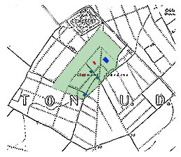
This map shows every path of the allotments. This is the map Joan used to plot the site of the allotments.